Search This Blog

Sunday, 22 September 2013

ROCKY BEND, YARROW CREEK NEAR GLEN INNES NEW SOUTH WALES AUSTRALIA

ROCKY BEND, YARROW CREEK NEAR GLEN INNES 
NEW SOUTH WALES AUSTRALIA
Rocky Bend is a location which few of those who have come out on the Baptist Church Wednesday fossicking trips would ever have heard of. In fact, the last time we went there was in April 2007. The main problem was the distance we needed to walk from our cars. At Minerama that year it had been possible to get there in 4 WD vehicles but the track was basically non-existent and in any case conditions were drier than normal that year and we always had other good locations elsewhere on Yarrow Creek.
Readers need to be reminded that this is all private property. 

The site is about a 15 minute walk downstream from the Yarrow Creek bridge on the Mt Slow road. There is no gate. Keep to the left bank because the property boundary basically follows the creek. About 100 metres below the bridge the water is backed up by rocks at Rocky Bend so basically the creek is one continuous pool from there down. It’s my belief that the creek formerly flowed on the other side of a rocky ridge from near the bridge, but as that is on a different property this hypothesis is yet to be checked out.
Minerama 2007 find
A group effort at Minerama 2007
The main dig at Minerama 2007 was where the stream channel is choked with sand up against a large rock outcrop. Digging revealed lots of gravel, frequently embedded in white clay, and rich in black jack and gem stones. Keeping the sand out of the underwater hole is the main problem. There is a lot of good potential along this stretch of the creek.

My finds from the Minerama 2007 day


Monday, 16 September 2013

THE BLACK JACK HOLE, YARROW CREEK NEW SOUTH WALES AUSTRALIA

THE BLACK JACK HOLE, YARROW CREEK NEW SOUTH WALES AUSTRALIA

This is the next productive area upstream from the Glory Hole in Yarrow Creek. I don’t recall actually seeing it until 2006 simply because in walking to the Glory Hole we had always cut off the bend in which the Black Jack Hole is located. When I first fossicked there, it was immediately obvious that there was a large amount of black spinel in a hole just below a rock on which any self respecting fossickers would have upended their sieves. We clearly weren’t the first to fossick there.

Nevertheless, the place has continued to produce cutters of all the typical Yarrow Creek gemstones – in cracks, under rocks, in scratchy areas under tea trees – and I have no doubt there are many more there yet.

One of my first jobs was to try to lower the water level, even just a little bit, to make it easier to work in the deeper water. This involved digging a channel through a sand blockage which was forcing the water to flow over a nearby rock bar. There are times when a 10 or 20 cm drop makes all the difference and this was one of them. There is probably more that can be done there yet.

One curious event happened after I had been taking groups there over several years. Unexpectedly, small, highly polished pieces of what I assume is rhodolite garnet began to turn up in one spot. Over several visits I found at least 20, some of them in the top sieve. I assume that someone on one of our Wednesday trips deliberately “salted” the spot with a sprinkling of tumbled garnet. Thanks, whoever it was – it made a change from finding pyrope garnet (the unpolished variety). Throw some gold nuggets in next time, please.

Visit my YouTube site here where you will find a video of the Black Jack Hole in the collection. 


Saturday, 7 September 2013

ROCKY PONDS CREEK, GLEN INNES NSW AUSTRALIA

ROCKY PONDS CREEK, GLEN INNES NSW AUSTRALIA

The first place in the Glen Innes district where I looked for gemstones is the creek which runs through the heart of Glen Innes, the Rocky Ponds. I was camping at Craigieburn Tourist Park (the one with the granite boulders) at the beginning of 1988 and soon discovered that the creek contained sapphire and zircon. That was my one and only fossicking outing in Glen Innes as I looked for more productive places elsewhere.

I don’t know what the course of the creek was like before it was confined in a channel through the central park lands, but above Wentworth St and below Ferguson St the creek at least has a more natural look about it. The upstream section (from there to the granite outcrops at Craigieburn) has less road gravel and rubbish than the lower, but whether there is anything of interest to be found there, I have no idea.

I have heard stories from older people about sapphires being found in “the park creek” in earlier times, though where this was and what was found, who knows? About 20 years ago I was invited to look at gravel being brought to the surface in a trench near the Grafton St causeway and this gravel certainly contained sapphire, spinel and zircon. I have also heard stories of sapphires being found in various parts of Glen Innes, all of which drain into the Rocky Ponds.

The map is extracted from Quarterly Notes 103 (1997) (DIGS reference QN 103) and it clearly shows gem bearing wash above the granite outcrops at Craigieburn. As with most of the town area, this is basalt country.

It is worth downloading the following document from DIGS: GS1969/576 Prospecting Reports Rocky Ponds Creek 1969. I have reproduced a copy of RE Brown’s report relating to it from Exploration Data Package for the Glen Innes 1:100,000 Sheet Area” (1995). The DIGS reference is GS1995/231.
It would appear, then, that this area is at least worth a second look (with permission from the relevant landowners, of course.)
You never know, you might be able to show off a fine gemstone found by yourself in Glen Innes’ own creek.

You can experience fossicking around Glen Innes through my YouTube site here


Tuesday, 3 September 2013

GARNET CORNER, YARROW CREEK NSW AUSTRALIA

GARNET CORNER, YARROW CREEK NSW AUSTRALIA

This has always been one of my favourite gem hunting spots along Yarrow Creek, made more so by the fact that the track to it is often impassable, meaning months could go by before we could drive down to it. The name was given by us and now the landowner uses it as well. It’s not that the other Yarrow Creek gemstones are lacking at Garnet Corner but rather that pyrope garnets are more abundant.  

This naturally makes one suspect that the source of the garnets is nearby, especially as the garnets are all quite rough and irregular here, and this is where we have found our largest specimens (several of around 30 carats). This has not been confirmed, but the geology of this place is different from anywhere else along the creek.
Firstly, the granite outcrops cease abruptly and, after a short space with no rock outcrops, a long but fairly narrow outcrop of a different rock takes its place. This is a gabbro dyke and from its appearance on satellite photos, it is almost certainly a ring dyke. Once past the dyke there is an extensive area, almost circular, where again no outcrops are seen. 
Garnet Corner is in the centre. The gabbro outcrop is to the left of it

Secondly, geologists have decided that this is most likely a diatreme, which would normally include fragments of rock brought up from deep down in the Earth’s crust or even the mantle. Perhaps amongst these are fragments which weather to release the garnets.  Some prospecting for diamonds has taken place in the nearby Kelly’s Hut Creek, but not only did this draw a blank, but even the normal Yarrow Creek gemstones were absent.

There are outcrops of a pale, crystalline rock in the creek bed at Garnet Corner, but nearly always what is found beneath the sand and gravel is a distinctive green clay, which rapidly turns 
Gabbro pieces in the alluvium
brown when exposed to the air. Digging into this has produced nothing of interest. However, it is the chunks of gabbro which have washed down from the neighbouring hill that fossickers are looking for. Their rough surface holds onto the abundant black spinel and the gem minerals.

Downstream of the first granite outcrops the gabbro chunks (I can’t call them pebbles because they are never rounded) rapidly disappear, so easily does this ferromagnesian-rich rock weather away. We don’t know what happens above the last gabbro outcrop as this is on an adjoining property to which we have no access. If there are garnets in the alluvium there, then maybe there is some other origin for the garnets than the one suggested here.
 The fact remains, however, that Yarrow Creek and a few of its tributaries are the only local source of pyrope garnet gems. Even the tributary streams could well have prior courses of Yarrow Creek in their drainage areas, something I have long suspected. It’s up to someone else to solve this mystery. Meanwhile, I hope you get a chance to find some of these beautiful gems at Garnet Corner.
Check out my fossicking videos from around Glen Innes here. The one dealing with Garnet Corner is here

Monday, 2 September 2013

BACK CREEK, PINKETT NEAR GLEN INNES, NSW AUSTRALIA

BACK CREEK, PINKETT NEAR GLEN INNES 

NSW AUSTRALIA

Back Creek is the first major creek south of Yarrow Creek on the Pinkett road, about 25km south east of Glen Innes. As seen from the road, there are numerous granite outcrops, especially on the eastern side. Near the point at which the creek moves away from the road, outcrops disappear and sand appears to make up the creek bed from here on. At the point where the Pretty Valley road crosses Back Creek there is nothing to be seen but sand. All this country is private property, needless to say, so access will need to be arranged for fossicking.

The above quote comes from the book “Exploration Data Package for the Glen Innes 1:100,000 Sheet Area” by RE Brown (1995). The DIGS reference is GS1995/231. It strongly suggests that good gemstones are to be found in these south eastern areas. Our numerous trips to Yarrow Creek confirm that this is indeed true; however there have been sapphire mines at various places along the Yarrow where sufficient accumulation of wash has happened. 

Yarrow Creek is shown as a sapphire bearing stream in the following references:

Sapphire in NSW 1983 DIGS reference Information Brochure 40, Sapphire in NSW 1995 DIGS Information Brochure 41, Quarterly Notes 103 (1997) DIGS reference QN 103, Records of the Geological Survey of New South Wales, Volume14, Part 1 by AA McNevin (1972) DIGS Records 14(1) . 

Back Creek topaz
Interestingly, neither Pretty Valley, nor Rainy Swamp nor Back Creek appear on any of the maps in these references. In the case of Rainy Swamp sapphires were certainly mined there. Pretty Valley appeared to be virgin when we first investigated it. Back Creek showed signs of old prospecting along both of its major tributaries upstream of the Pinkett road. Yet no trace could be found in DIGS of any mining or prospecting in these three areas. All three have produced good gemstones on our many visits.

I have mentioned in the Blog entries on both Rainy Swamp and Pretty Valley that their gemstones differ from those in Yarrow Creek, but resemble each other. The same is true for the gems from Back Creek. Indeed, I think it likely that the Rainy Swamp deposit is a former course of Back Creek. It would not be difficult to imagine Back Creek having formerly flowed where Bladey Grass Creek is today (Pretty Valley).

The typical wash from Back Creek produces a concentrate containing sapphire, zircon, spinel, tourmaline, topaz and cassiterite. There is a great deal of clear and smoky quartz. The topaz has been found in pieces up to 150 carats, mostly colourless but with some blue and apricot coloured stones. There is a lot of black tourmaline and I have seen one piece only of gemmy tourmaline. The sapphire is mostly opaque but clear stones of all the usual colours turn up. There is a little beryl to be found as well.
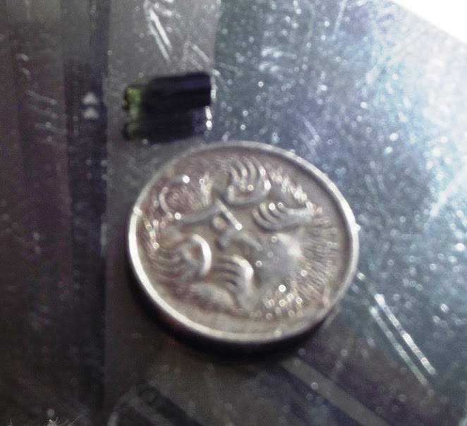
Gemmy tourmaline from Back Creek
I have seen two “bonanzas” found there when dozens of cutters suddenly appeared in a relatively small area. I was involved in finding a third and it was extraordinary to come upon wash peppered with all the gems mentioned when it was normal to see just a few in the sieve. That’s what gem hunting is all about and I have to say that it was a sad day when we lost access to the best part of the creek in 2002. This was the result of fossickers on a Minerama trip not filling in their holes.

If I ever had the opportunity to fossick again, Back Creek would be the place I would go.

I have no photos of fossicking at Back Creek, unfortunately, and just a few of some finds from there. I’m looking forward to reading about future successes by readers of this Blog. 

You can experience fossicking around Glen Innes through my You Tube site until you pay the area a visit. Click here

Back Creek topaz