WHERE ARE SAPPHIRES FOUND?

There are two kinds of gem deposits in the Glen Innes area: Primary and Secondary or alluvial.
The primary deposits are those containing the gems in the original rock or weathered material formed from it. The secondary deposits are concentrations found in present day streams, abandoned stream channels and deep leads or buried stream channels.
The only primary deposits the
casual fossicker is likely to meet are at the DeJon mine on the Gwydir Highway
at Elsmore and at the Wellingrove Fossicking Reserve.

Quarry at DeJon mine
At the Wellingrove Reserve, there
is no sign of the overlying basalt, though it is visible in road cuttings just
before the turnoff into the Reserve. The sapphires are found in reddish clay
overlying the Wellingrove granite. This clay is evidently the weathered remains
of volcanic material ejected over the area immediately before the outpouring of
the basalt. Fossickers will soon notice the absence of typical water worn sand
and pebbles in the so-called "wash". The greatest concentration of
gems is in the bottom few centimetres of clay, which may be buried beneath
several metres of soil.
Wellingrove wash and granite boulders

Alluvial deposits are found in
stream beds all over the district. The major requirement for finding
concentrations of gems is to be searching in an area where there are outcrops
of bedrock in the creek to act as traps. Otherwise the dense gemstones will be
buried deeply in the gravel and inaccessible to the casual fossicker. This
rules out most of Reddestone, Wellingrove and Furracabad Creeks and the Beardy
Waters. In other places, it's necessary to think of how the water behaves in a
major flood, because this is the only time the dense gemstones are actually
shifted. They will then be deposited in places where there is a sudden decrease
in stream velocity such as in the lee of boulders, below rapids etc. These are
the places to identify and search for the best results.
Where Do Sapphires Come From?
Throughout NSW and Queensland, sapphires are nearly always found in areas where basalt rock has been eroded. Occasionally one turns up in a basalt floater (loose piece of solid basalt) or in soil overlying basalt rock and clearly formed from it by weathering.
It's believed that some sapphires are found throughout the extensive basalt lava flows of New England, brought up from deep within the Earth by rising magma some 37 million years ago. The result is that almost every stream between Glencoe and Dundee, Glen Elgin and Inverell holds its quota of marvellous blue, green, yellow and particolour sapphires.

digging for gravel in Yarrow Creek

Investigations at Elsmore and in the Kings Plains and Wellingrove areas suggests that the greatest concentration of sapphire and the other dense minerals is in volcanic ash beds which lie below the first great lava sheets. These are the product of the explosive activity which took place when the volcanic cycle commenced. Weathering of these rocks has released the precious stones to be concentrated in modern creeks and ancient deep leads by virtue of their greater hardness and density.
The distribution of sapphires suggests that other explosive centres may have been located near Mt. Slow, Glencoe, Furracabad and Bald Nob. The search is on to locate sapphire bearing rocks in these places. If these deposits prove to be economic, Glen Innes will be a source of precious stones for hundreds of years to come.
Minerals Found in Gem Gravels.
The process of concentration which takes place during sieving should separate out all the dense minerals found in the wash. The other materials, mostly pebbles of various rocks and quartz (as worn

crystals and vein fragments) have specific gravities between
2.5 and 3.1. That is, they are 2.5 to 3.1
times denser than water. Of these, only some of the crystalline quartz is
likely to interest the fossicker.
The denser minerals, with their specific gravities, are as follows:
corundum (sapphire & ruby) 4.0 pleonaste (black spinel, commonly called blackjack) 4.1 zircon 4.7 garnet (most often pyrope) 3.5-3.7 topaz 3.4-3.6 enstatite and hypersthene 3.2 - 3.5
tourmaline (the black schorl variety) 3.0 - 3.3 cassiterite 6.8-7.1 "ironstone" (ferruginous bauxite) 2.5 - 4.0 depending on the iron content.
Not all of these will be found together. The typical sapphire concentrate will consist of ironstone, corundum, zircon, garnet and pleonaste; less commonly topaz and enstatite will turn up. Tourmaline and cassiterite can be expected in tin areas around Backwater, Tingha, Emmaville and Torrington.
How to Recognise the Various Minerals.
Nothing beats being shown by an expert, but it is comparatively easy to distinguish the various minerals. Ironstone is opaque, reddish brown to black which crushes to a red powder. Pleonaste is invariably found with sapphire in New England. It is black and lustrous and occasionally confused with corundum, especially on bright sunny days.

Corundum is the mineralogical name of the mineral whose transparent varieties include ruby and sapphire. The name ruby is reserved for the red variety of corundum, all other colours being
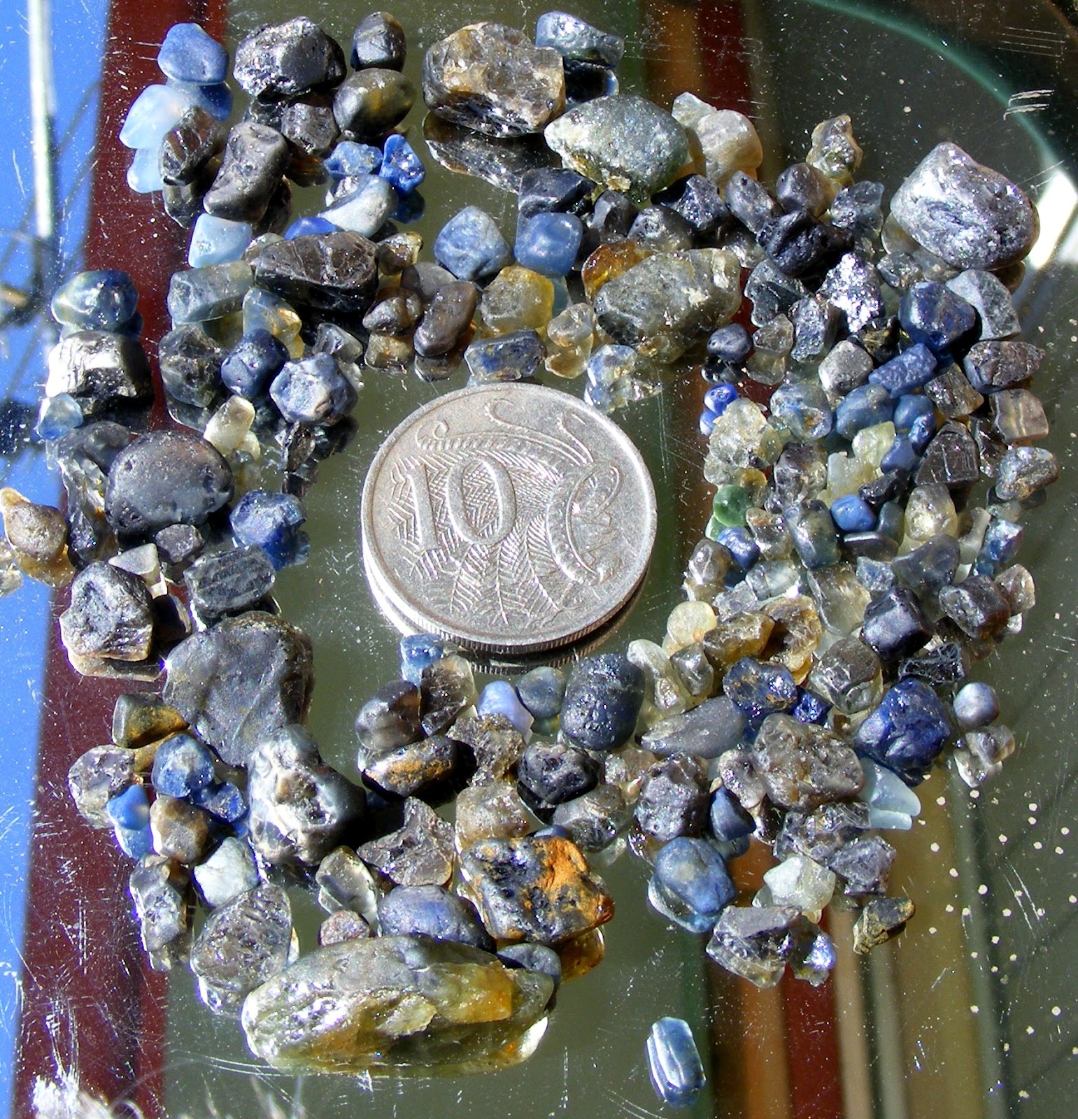
known as sapphire. To the miner, the term "corundum" means the nongem quality mineral. It occurs in barrel shaped hexagonal crystals, pieces of crystals and rounded fragments. These may be up to 4 cm across. If broken, the mineral usually displays flat, very lustrous parting surfaces. Colour zoning both along and across the crystal is common.

Zircon is a highly lustrous mineral with a high refractivity which sets it apart from other minerals in the wash. Zircons have been found up to 3 cm across.
Pyrope garnet is characteristically deep red in colour and usually dull in lustre (unlike zircon). Garnets frequently have rough, irregular surfaces, again unlike zircons which often display flat cleavage surfaces.

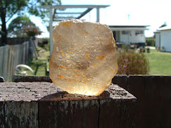
Topaz is found as colourless to
pale blue pebbles, sometimes 2 or 3 cm in diameter. Highly reflective cleavage
surfaces are commonly seen, which distinguishes topaz from quartz but not
necessarily colourless zircon. Topaz pieces tend to be larger than the other
gemstones.
Topaz Scrubby Gully Torrington

Enstatite and hypersthene are
somewhat softer minerals than the others. They are occasionally found as
brownish green to emerald green fragments which are quite unlike others in the
wash.

Tourmaline is occasionally seen
as black or brownish crystal fragments which have a characteristically rounded
triangular cross section. The sides are often deeply striated.

Cassiterite is exceptionally dense and has a distinctly metallic lustre. It is usually reddish brown to black and highly lustrous.
Equipment
Needed for Sapphire Fossicking.
Because water is nearly always available, gem fossicking around Glen Innes is comparatively simple. The basic equipment you need is a pair of sieves (coarse and fine), a shovel (the longer the handle the better), a plastic bottle with lid for your finds and a pair of tweezers for picking them out of the concentrate.
For working hard ground like that at Wellingrove Reserve, a pick and crowbar are very useful. They are also invaluable in moving rocks in stream beds. A long handled shovel can help you get gravel out from under boulders, from pot holes and from cracks in the bedrock. A one metre steel probe is very useful for locating holes under sand or gravel while a jam tin and perhaps a piece of steel wire are excellent for scraping wash out from between boulders where gems have a tendency to get caught. Many people find a yabby pump valuable for extracting wash from cracks and other hard-to-get-at places underwater.
John G. Paix ©
Glen Innes Business Enterprise
Centre
June 1991