THE DUNDEE GRAVEL BEDS
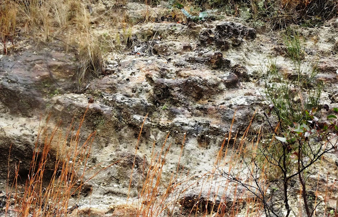
 I first noticed quartz gravel
in a road cutting on the Ranger’s Valley road near Dundee over 20 years ago.
The location is 4.1km from the New England Highway, immediately before the road
crosses the abandoned Wallangarra railway line.
For several hundred
metres the road passes through low cuttings of poorly compacted sandstone
containing layers of gravel. So far as
I have seen, all the pebbles are quartz
and all are quite waterworn. Some are clear or smoky, but these make up only a
few percent of the whole.
The obvious question is,
where have they come from? The local rock is the Dundee Rhyodacite (locally
called the blue granite).
It is a quartz deficient rock and I have not seen
evidence of quartz veins in it anywhere. It is unlikely to be the source of the
quartz pebbles.
The nearest major stream
is the Severn River, which runs a km or so to the south. I haven’t seen gravel
like this is the river but it is still possible that this outcrop represents an
old course of the river.
I believe that the most
likely source of the gravel is the eastern end of the Mole Tableland in the
vicinity of Stannum, about 30km to the north. Observations at Stannum reveal
that a former stream bed vanishes beneath a younger flow of basalt. This is the
classic “deep lead” situation and the Stannum Deep Lead has been traced beneath
the basalt at least as far south as the Deepwater-Emmaville road. There are in
fact up to 10 separate flows, which would have followed down the old valley,
completely burying it and its alluvium.
Tin (cassiterite) has
been mined from this gravel near Stannum, but the wash became less economic as
it was traced southwards beneath the basalt. This is to be expected, as the
cassiterite naturally became finer as it was carried further from its source.
Not only that, but it becomes more difficult to locate the centre of the old
lead beneath the basalt and most of the boreholes which were sunk missed the payable ground which might exist in the centre of the old valley.
The gravel at Dundee has
no basalt cap, and the nearest outcrop of the Stannum basalt is a few
kilometres to the north, but it is quite possible that it is part of
the alluvium present in that ancient valley.
Reports on the Stannum
Deep Lead mention zircon and spinel among the denser minerals found with the
tin, but not topaz. I found no topaz when I carried about 20kg of gravel down
to the Severn River and washed it. There was a residue of dense black sand which no
doubt included cassiterite. Others have reported finding topaz here but this
might have been clear quartz which is easily mistaken for it.
The easiest way to get
specimens of clear and smoky quartz at this spot is to gouge out pebbles that look dark.
Otherwise, if conditions allow, dry sieve the loose material and then wash it
in a convenient puddle or take it down to the river. (The Severn River Road
branches off the Ranger’s Valley road before you reach the cutting.)
A good reference is “The
Stannum Alluvial Tin Deposits” by PL Rasmus, 1968 (DIGS GS1968/221).
Why not check
out my You Tube channel here where you can view gem hunting, mining and general geology videos. New subscribers are always welcome.
https://johnsbluemountainsblog.blogspot.com/2013/12/links-to-all-blog-entries-and-relevant.html All Blue Mountains blogs and videos
All New England and other Geology blogs and videos
Limestone Caves of NSW
Song Studies. Bible studies based on hymns and songs
Shoalhaven District Geology.


No comments:
Post a Comment